
This topic describes how to define the geographic area for an IPAWS alert by drawing regions on the map.
-
On the IPAWS template or alert page, click the Select Location button under the Message Details section.
The Choose Geographical Locaiton dialog displays.
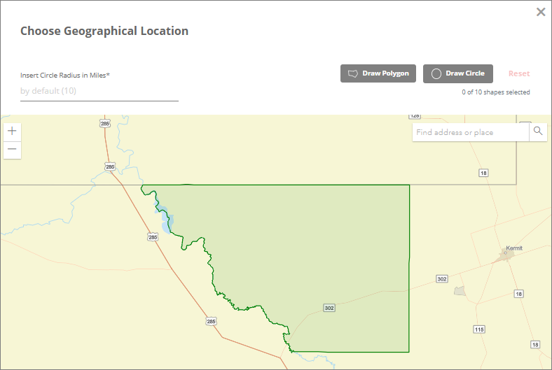
In the Choose Geographical Location dialog, draw a region on the map to define the geographic area for the IPAWS alert. You can create the region using either a circle or a polygon. The region you draw must remain within the authorized boundary. The authorized geographic boundary is determined by the selected IPAWS key and is highlighted in green on the map. Because authorized areas can vary between IPAWS keys, changing the selected key may also change the geographic area in which you are permitted to send alerts. If any part of a circle or polygon extends beyond authorized boundary, an inline validation message is displayed, prompting you to remove or redraw the shape within the permitted area.
Note: If you change the IPAWS key after defining a region, the system validates the existing region against the authorized area associated with the new key. If the previously selected region falls outside the new authorized boundary, you must remove or redraw the region within the new authorized area before you can send the IPAWS alert.
To draw a region on the map.
-
Click one of the following shape options to define the region:
-
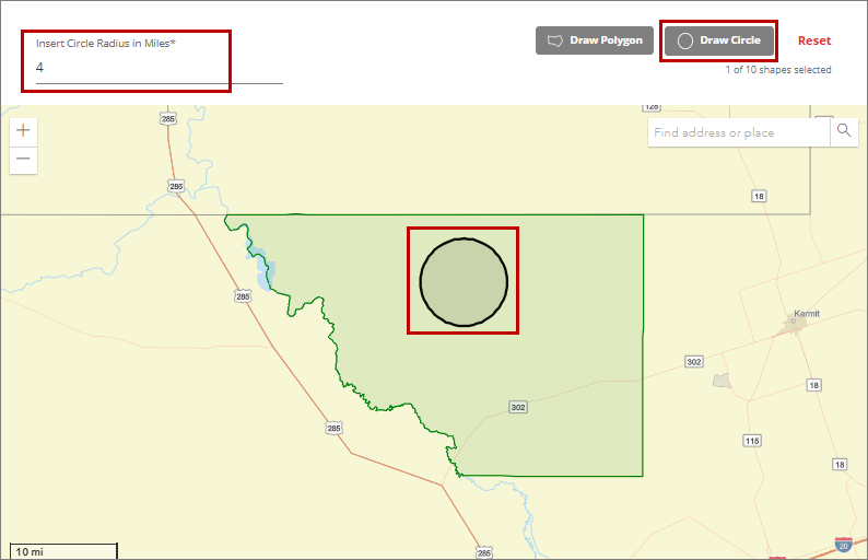
Draw Circle: Use this option to draw a circular region on the map. To draw a circular region, specify the circle radius in miles in the Insert Circle Radius in Miles field. If you do not specify a radius, the circle will be drawn on the map using the default radius of 10 miles. After specifying the circle radius, click the Draw Circle button, then click on the map at the location where you want to center the circle.The region will be created as a circle based on the specified radius.
-
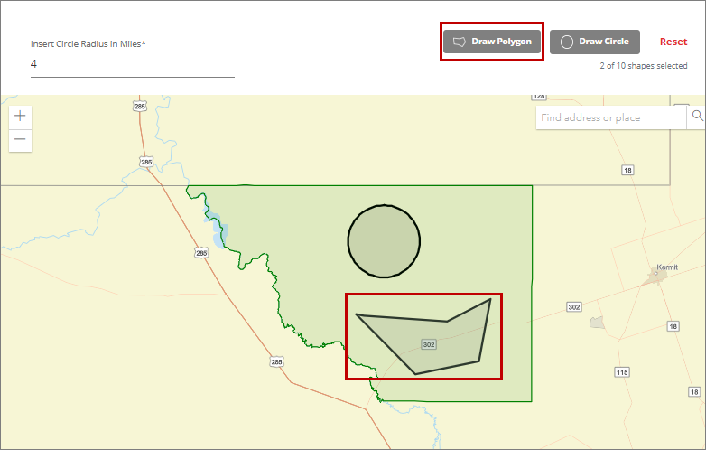
Draw Polygon: Use this option to define a custom-shaped region on the map. Click the Draw Polygon button, then click the map to place the first point. Move the cursor to the next location and click again to add another point. Continue clicking to connect multiple points and form the desired polygon shape. Once the shape is complete, double-click anywhere on the map to finish and confirm the region.
Note: The location provided by the system may not always be precise. Several factors can influence the accuracy of location data, including:
-
Device settings and permissions: If location services are disabled, restricted, or set to approximate location, the system may not be able to determine an exact position.
-
Operating system behaviour: Different operating systems and versions handle location detection differently, which can impact consistency and precision.
-
Network connectivity: Location may be derived from Wi-Fi networks, IP addresses, or cellular data. Weak signals, VPN usage, or limited connectivity can reduce accuracy.
-
Environmental conditions: Physical surroundings such as buildings, indoor locations, or remote areas can interfere with GPS signals and affect accuracy.
-
-
-
Optionally, click Reset to remove the currently drawn regions from the map, then draw the new regions as needed.
-
After you have finished drawing the geographic regions for the IPAWS alert, click Done to confirm your selections.